
PHOTO COMPETITION
2021 Photo Competition
Vote Here

1. Sunset photo with cloud formations.
Location: Along Lake Champlain in Vermont, USA
Category: Climate and Weather
Twitter: @MannWeather
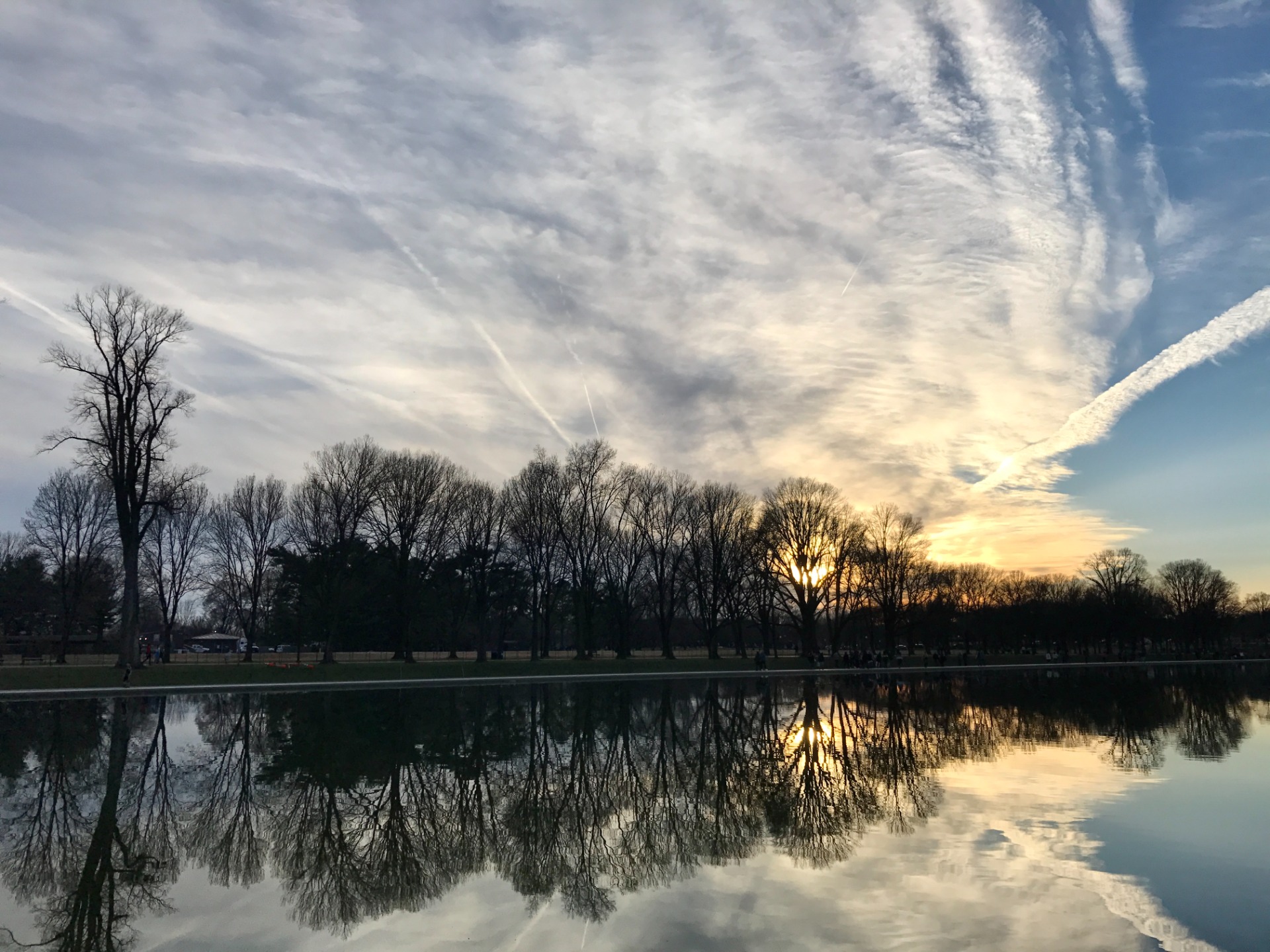
2. Sunset sky mirrored in the Lincoln Memorial Reflecting Pool.
Location: Washington D.C.
Category: Geography
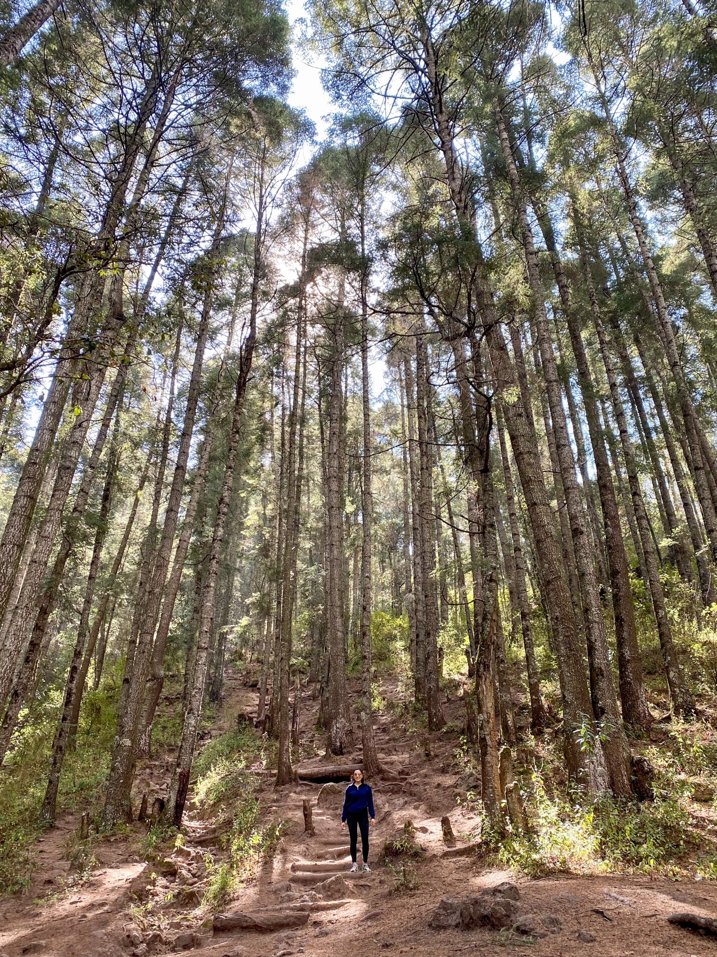
3. Trees at the National Park Mineral el Chico in Mexico.
Location: Mineral el Chico, Mexico
Category: Geography
Twitter: @carolinamayh

4. Atmospheric wind wave clouds
Location: Adelaide foothills at Magill, South Australia
Category: Climate and Weather
5. Walked through the thousand lakes region of the Central Plateau to do palaeoecology work for Sarah Cooley's PhD. We were coring lakes to reconstruct fire and pollen history of the Holocene in relation to Pencil Pine migration
Location: Central Plateau, TAS
Category: Geography
Twitter: @magee_harriet
6. Walked through the thousand lakes region of the Central Plateau to do palaeoecology work for Sarah Cooley's PhD. We were coring lakes to reconstruct fire and pollen history of the Holocene in relation to Pencil Pine migration. This photo was taken on the walk back after a 5 day hike.
Location: Central Plateau, TAS
Category: Geography
Twitter: @magee_harriet
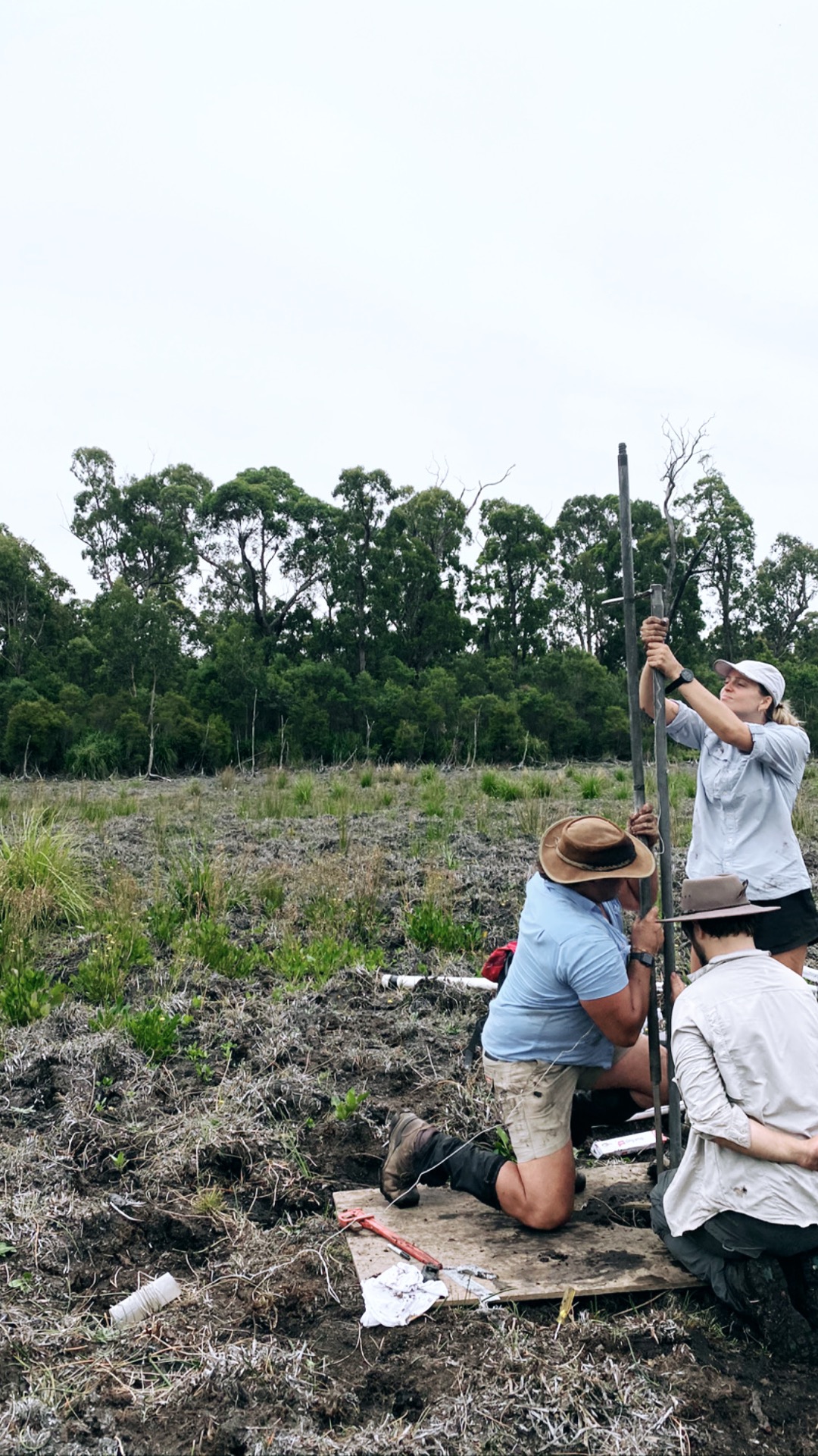
7. Here we were coring a bog for the PF-FIRE project at Wombat Creek. We are reconstructing the fire and pollen history to detect the impacts of Aboriginal burning on fuel types and loads, and fire frequency and intensity. This was the second of 4 failed attempts before we finally got the perfect core.
Location: Wombat Creek, East Gippsland, VIC
Category: Geography
Twitter: @magee_harriet

8. Stratovolcano in central Mexico, located about 80 kilometres west of Mexico City near the city of Toluca.
Location: Nevado de Toluca, Mexico
Category: Geography
Twitter: @carolinamayh
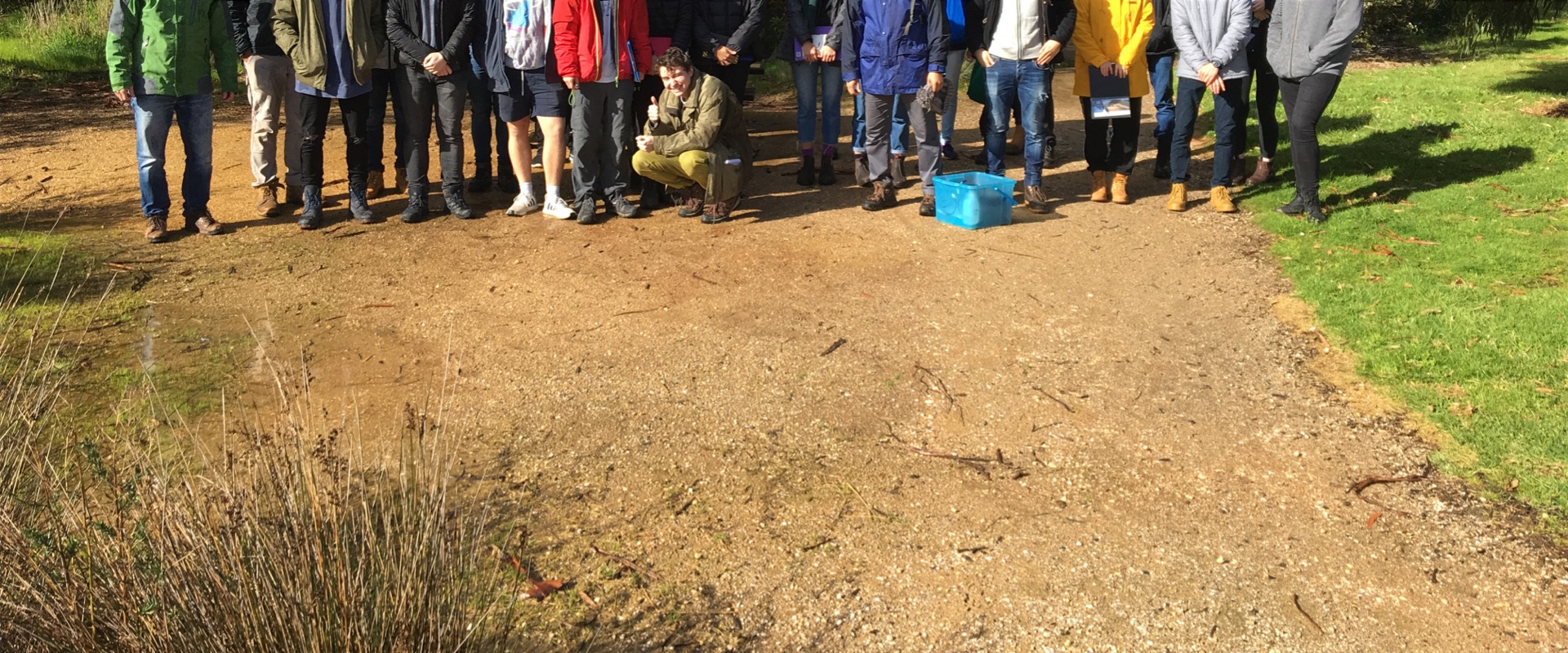
9. Environmental geology field trip
Location: Angelsea- Victoria
Category: Geology

10. Natural interference pattern created as waves from two different directions intersect.
Location: St Kilda Pier. St Kilda, Melbourne
Category: Climate and Weather
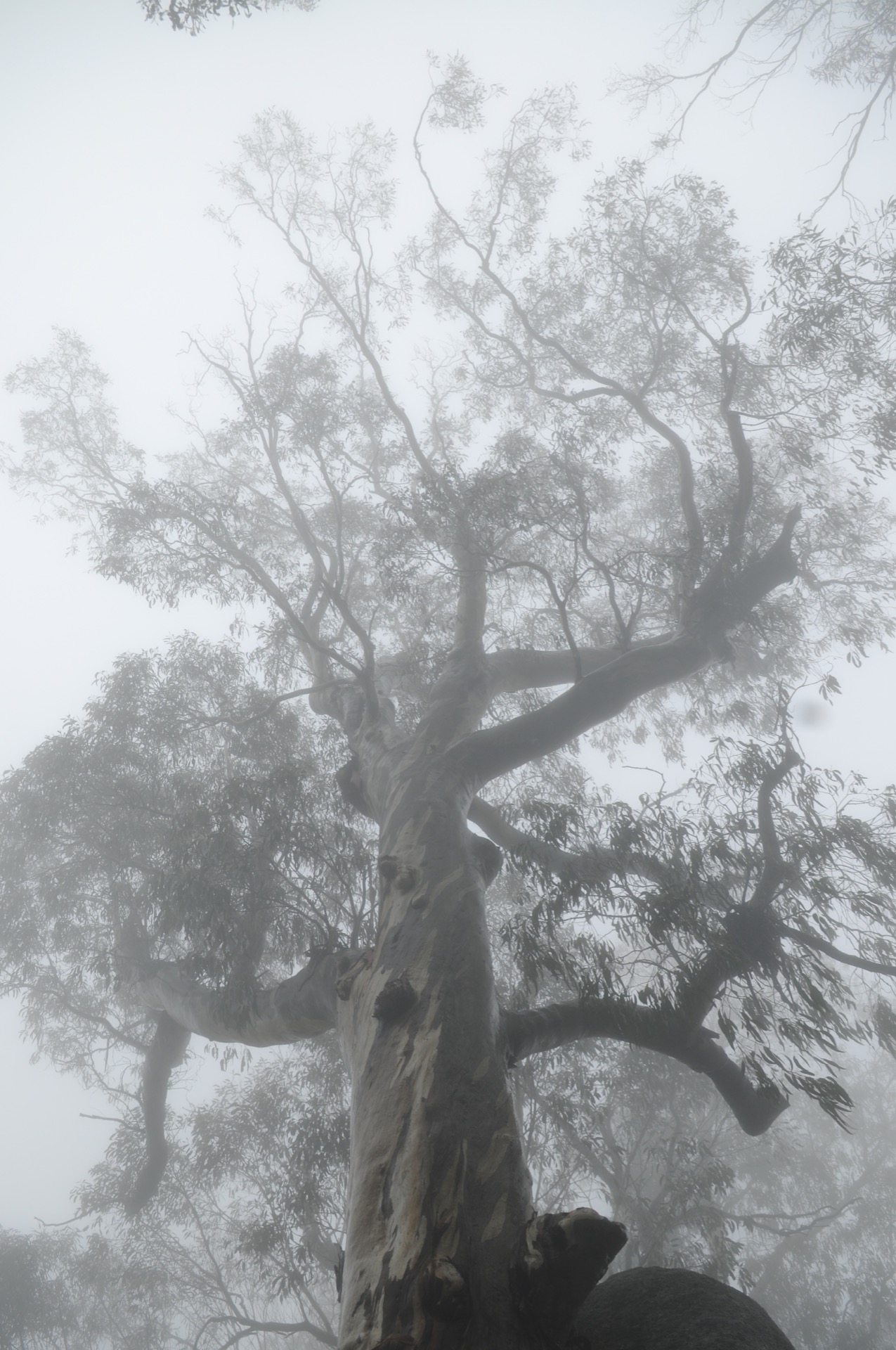
11. In amongst the clouds at the top of Mount Buffalo, normally the view shows the other mountains in the Alpine Shire but not on this day due to high amounts of fog!
Location: Mount Buffalo, Victoria
Category: Geography

12. Cloud Streets! These beautiful clouds are formed by "convection rolls" of rising warm air and sinking cool air. Warm air cools as it ascends. When moisture in the warm air cools and condenses, it forms clouds. Meanwhile, sinking cool air on either side of the cloud creates a cloud-free zone. Cloud streets develop when several of these alternating rising and sinking air masses align with the wind!
Location: On a flight back from Queensland
Category: Climate and Weather
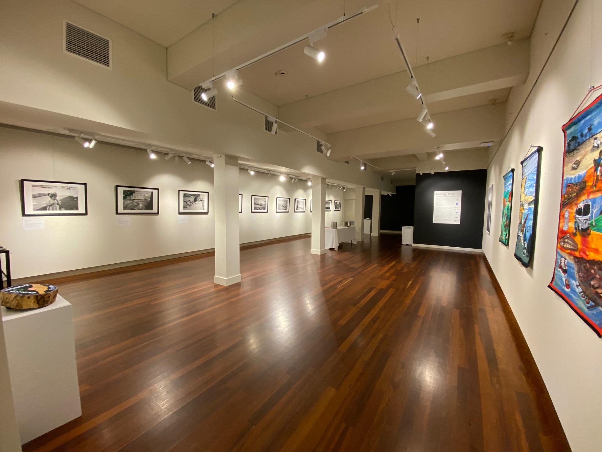
13. Knowledge translation is an important aspect of science. Art is one way to make research findings more accessible to general audiences. This photo is of the Finding Home touring exhibition which communicates findings from the Engaging Youth in Regional Australia Study funded by the Australian Research Council (2019-2021).
Location: Nautilus Art Gallery, Port Lincoln
Category: Geography
14. Boulders in the town of Magdalena Ocotlán, Mexico, March 2020. Participant, Antonio, shows us how the rocks are streaked with lichen, the colour of yellow highlighter. (**perhaps someone from geology can help me identify what type of rock this is!
Location:Valles Centrales, Oaxaca, Mexico
Category: Geography
Twitter: @ElenaTjandra
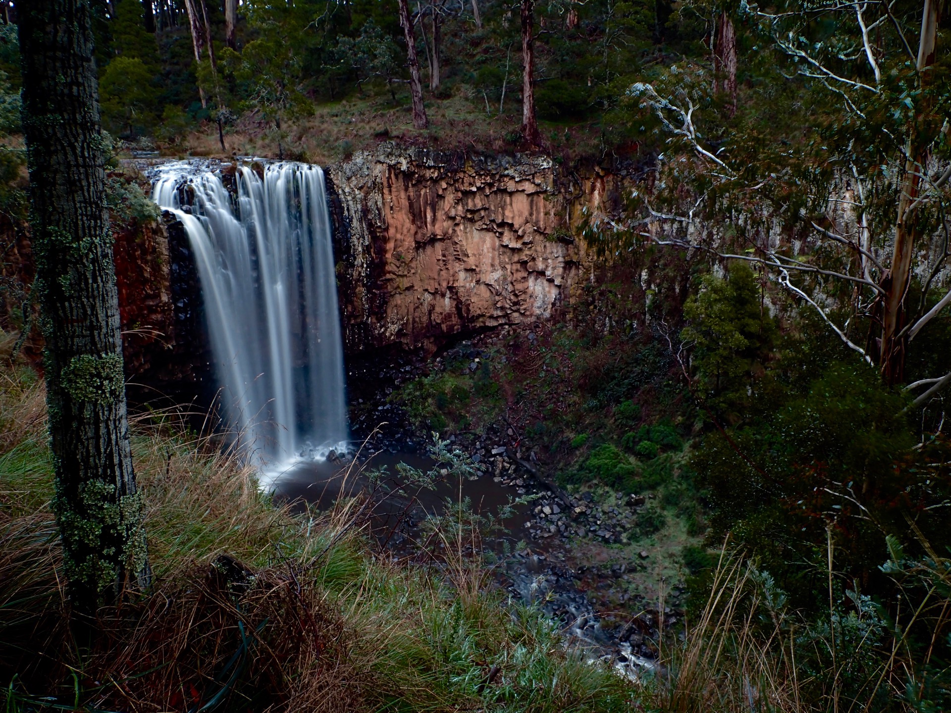
15. Fluvial geomorphology is often its most spectacular when constrained by geology. Resistant rock remains while the valley erodes leaving sensational waterfalls
Location: Trentham Falls
Category: Geography

16. Fishing on rock platforms is the most dangerous sport in Australia. a recent PhD investigated risks, and how experienced people could read the swell and move away before being washed out to sea.
Location: Punchbowl (San Remo)
Category: Geography
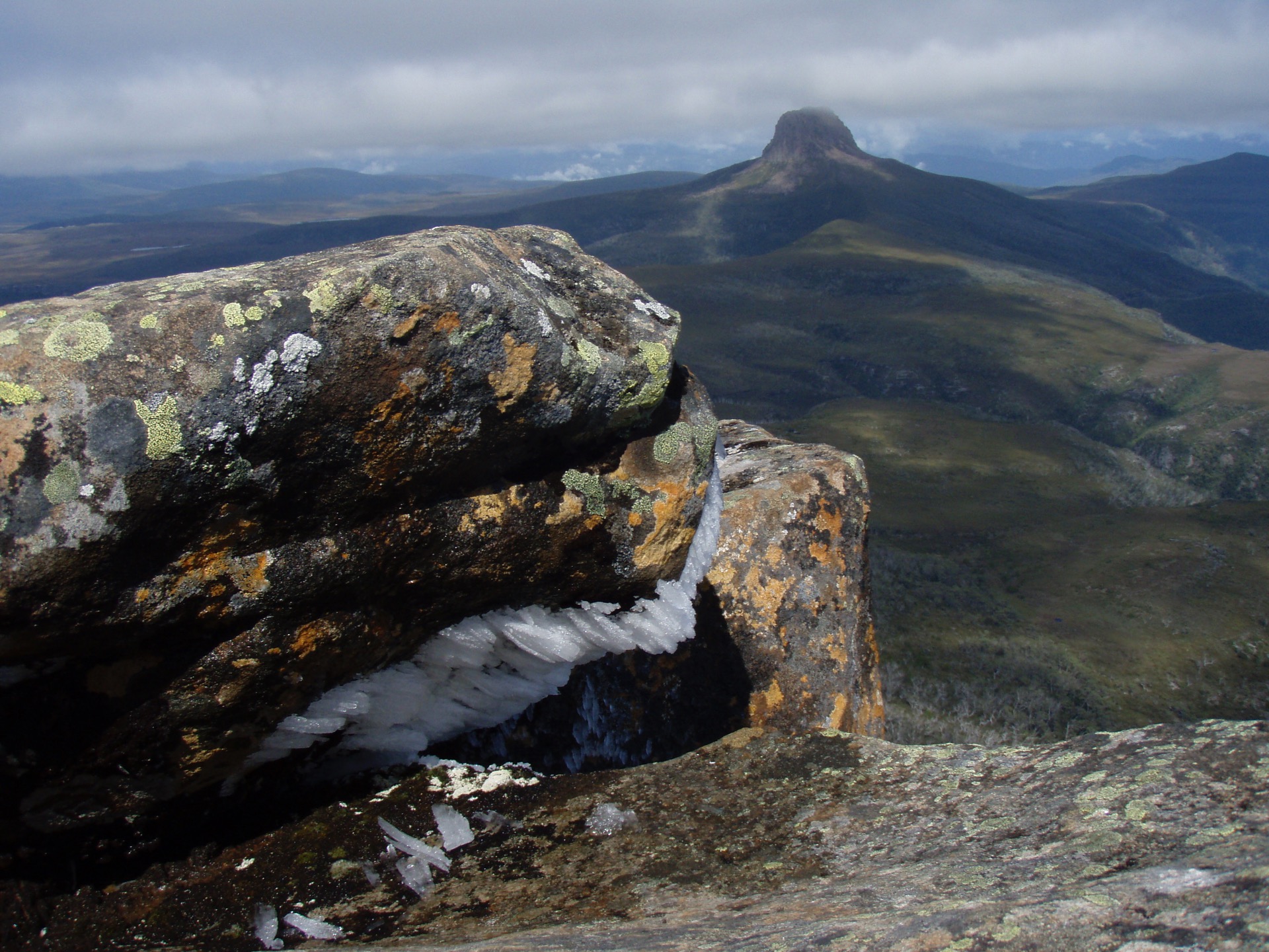
17. Cradle Mountain dolerite intruded into Permian sediments, wheras Barn Bluff in the distance intruded into Permian. Glacial action carved the features we see today, as recently as 18,000years
Location: Cradle Mt
Category: Geology
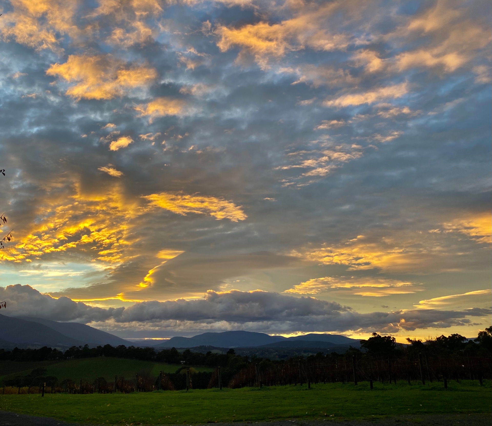
18. Sunrise beauty belies the risks of fire flooding, regimes changed by land cover change and by water catchments and dams. The Wurrunjeri - Woi Wurrung people of the upper Birrarung (Yarra) had a seven season calendar and two non-annual seasons. ENSO patterns were recognised before modern climate science, and there was fire season about every 7 years, and a flood season about every 28 years.
Location: Warburton Valley
Category: Climate and Weather
19. The recent fires in the northern part of Gariwerd, stripped back vegetation, revealing the Devonian sandstone, and liberating sandy sediments into alluvial fans on the plains below.
Location: Gariwerd (Grampians)
Category: Geology

20. This moment was captured on a lunchbreak on a Himalayan biogeography/hydrology field trip in Bhutan in 2017 before I knew I wanted to follow on as a human geographer. The holistic Gross National Happiness policies that have aided their achievement as a carbon negative Country feel evident in this photo. This family huddled on the mountainside, where prayer flags weave upon mountain tops between trees akin to the powerlines. This is a country that continues to hold the complexity between "modernity" and living culture and challenges Western notions of the nature/culture divide. It highlights several of Bhutan's policy priorities- such as increasing living standards and wellbeing through linking power access to rural communities, environmental policies to retain high percentages (71%) of national canopy cover and preservation of cultural diversity and resilience.
Location: Bhutan
Category: Geography
21. Field classes with vegetation study transects reveal species that flourish post fire.
Location: Gariwerd (Grampians)
Category: Geography

22. On the hunt for Precambrian fossils of the Ediacaran Period with a group of 3rd year students during an advanced mapping course in the Flinders Ranges. Yellow Footed Wallaby at Brachina Gorge/ Flinders Ranges spotted during lunch break.
Location: Brachina Gorge/ Flinders Ranges
Category: Geology
Twitter: @SchirinSellmann
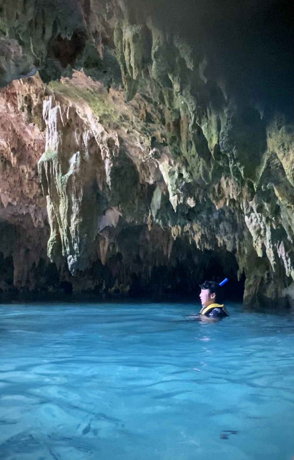
23. Sac Actun is an underwater cave system situated in Quintana Roo, Mexico. San Actun is 364.4 kilometres long, the longest cave in Mexico.
Location: Sac Actun, Mexico
Category: Geography

24. A lady's staring at their homes, places for livelihoods, and social life. Oceans are not only significant for coastal communities' livelihoods, but also are parts of their lives. In the ocean-based economy, women fishers contribute significantly to the fisheries sector, particularly through their involvements in pre and post-production stages. Yet, women fishers still encounter lack of recognition of their involvements, which affects the way in which they are able to access their rights and influence decisions. The coastal and sea- spatial use change, climate change, land use change, and socio-demographic change have imposed multiple challenges to fisherfolks and coastal communities in Indonesia - and elsewhere.
Location:Coastal area of the North Jakarta Indonesia
Category: Geography
Twitter: @naimahtalib
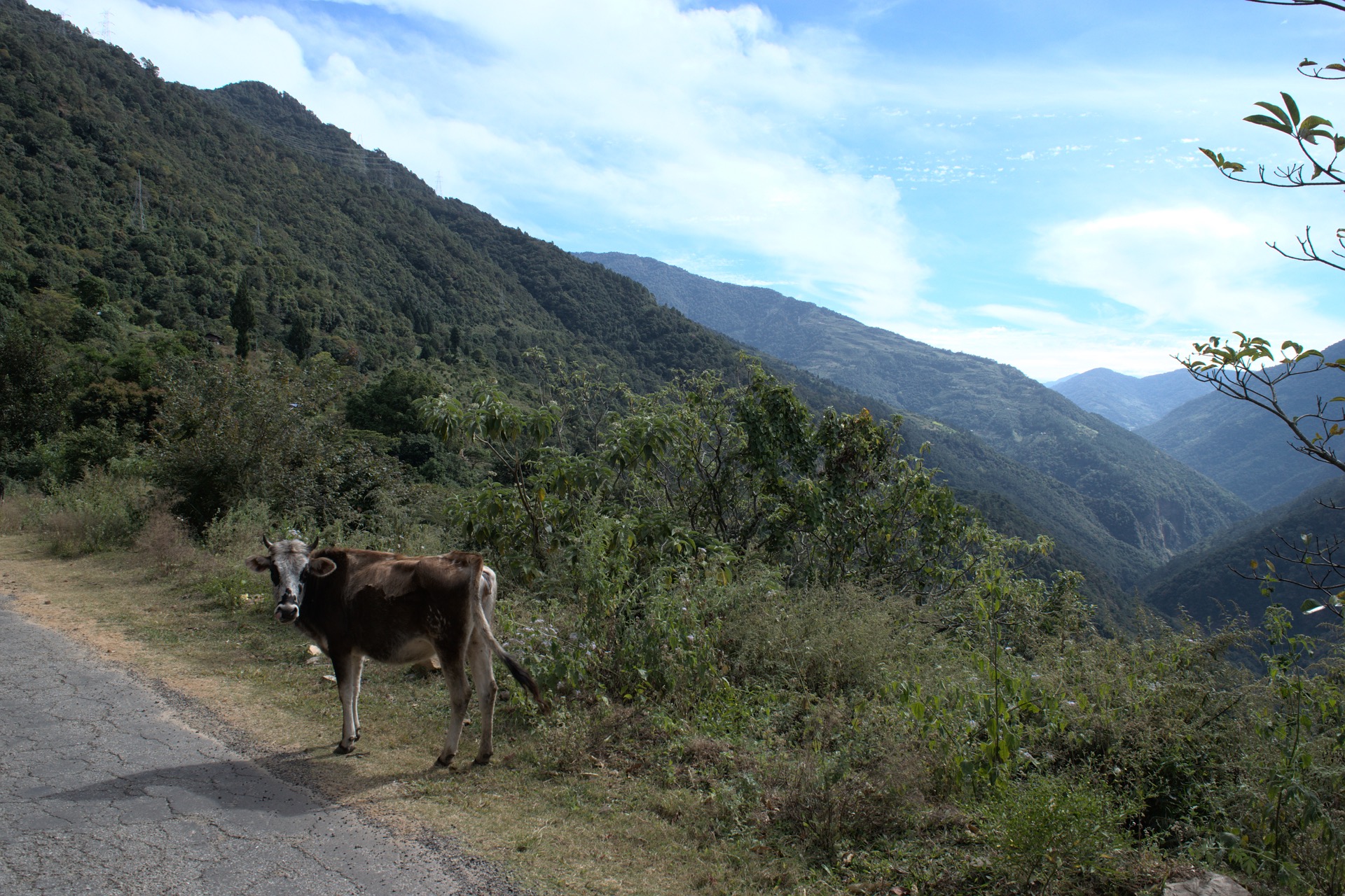
25. This photo was captured during a Himalayan Biogeography and Hydroelectricity fieldtrip to Bhutan in 2017 in a moment of reciprocal witnessing between myself and this cow. One of many who wander the steep roadsides as the Buddhist Bhutanese government does not allow killing of animals. It offered a moment to reflect on the notion of belonging. Passing through these places marketed as 'pristine' to high-paying Western tourists - I noticed these stray cows, unfamiliar and familiar 'weeds' (especially the florets of blue billygoat weed from my home in Brisbane) and strings of powerlines (dipping through the treetops of these globally renowned landscapes to provide electricity access to all rural residents), as active agents co-creating the cultural/natural environments of Bhutan.
Location :Bhutan
Category: Geography

26. Calcite crystals forming at the end of a stalactite. These crystal act as a time capsule and preserve geochemical information about the current climatic and environmental conditions above the cave.
Location: Exit Cave, Tasmania
Category: Geology

27. Time in the Cave
Inescapable! Even in the world's largest water cave, Ali-Sadr Cave, Iran; I took this photo in July 2019 while on a boat expedition with my family. Calcium sediments and current (at the bottom) and a history of water levels on the walls are visible in the photo.
Location:
Category: Geology
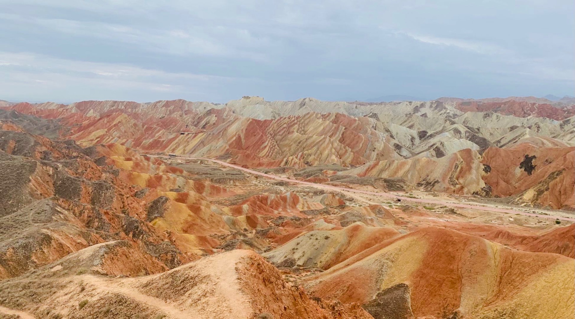
28. The Danxia Landform, the colorful mountains, in the northwest of China. Danxia landform is formed by endogenous forces and exogenous forces from red-coloured sandstones and conglomerates of largely Cretaceous age.
Location: Zhangye, Gansu Province, China
Category: Geology
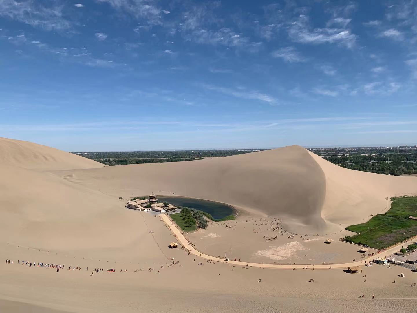
29. The Crescent Lake in the Kumtag Desert. It is formed from the subterranean river and have exited in the desert for thousands years.
Location: Dunhuang, Gansu Province, China
Category: Geology

30. Genus stratocumulus cloud photo taken from above.
Location: Airplane, Heilongjiang Province,China
Category: Climate and Weather
31. Rivers in the Pilbara are frequently diverted in association with mining activity. Here we inspect a large culvert leading into a river diversion channel.
Location: Pilbara, Western Australia
Category: Geography
Twitter: @AlissaJF
32. The Pilbara is an iron rich landscape. This alternating strata of fine materials and conglomerates make up the sediment of the piedmont and the alluvial plains which can be found in the banks of river channels in the region.
Location: Upper Fortescue Catchment, Pilbara, WA
Category: Geology
Twitter: @AlissaJF

33. Sugar cane processing creates sugar cane clouds in Australian's wet tropical belt. Particulates rising from the chimney welcome moisture in the humid air, sticking, rising and joining the banks of mid-afternoon cloud.
Location: North QLD, Australia
Category: Climate and Weather
Twitter: @MathildeRitman
34. Sun sets in the coastal sub-tropics, illuminating the bellies of cumuliform clouds, originally formed with the radiation now dissipating into the night.
Location: Noosa Heads, QLD
Category: Climate and Weather
Twitter: @MathildeRitman

35. The transition period where the two monsoons meet (known locally in the Maldives as Halhajehun) is marked with strong winds, heavy rain, rough seas but also with an occasional burst of sunshine.
Location: Theefaridhoo, The Maldives
Category: Climate and Weather
Twitter: @AishathAzfa
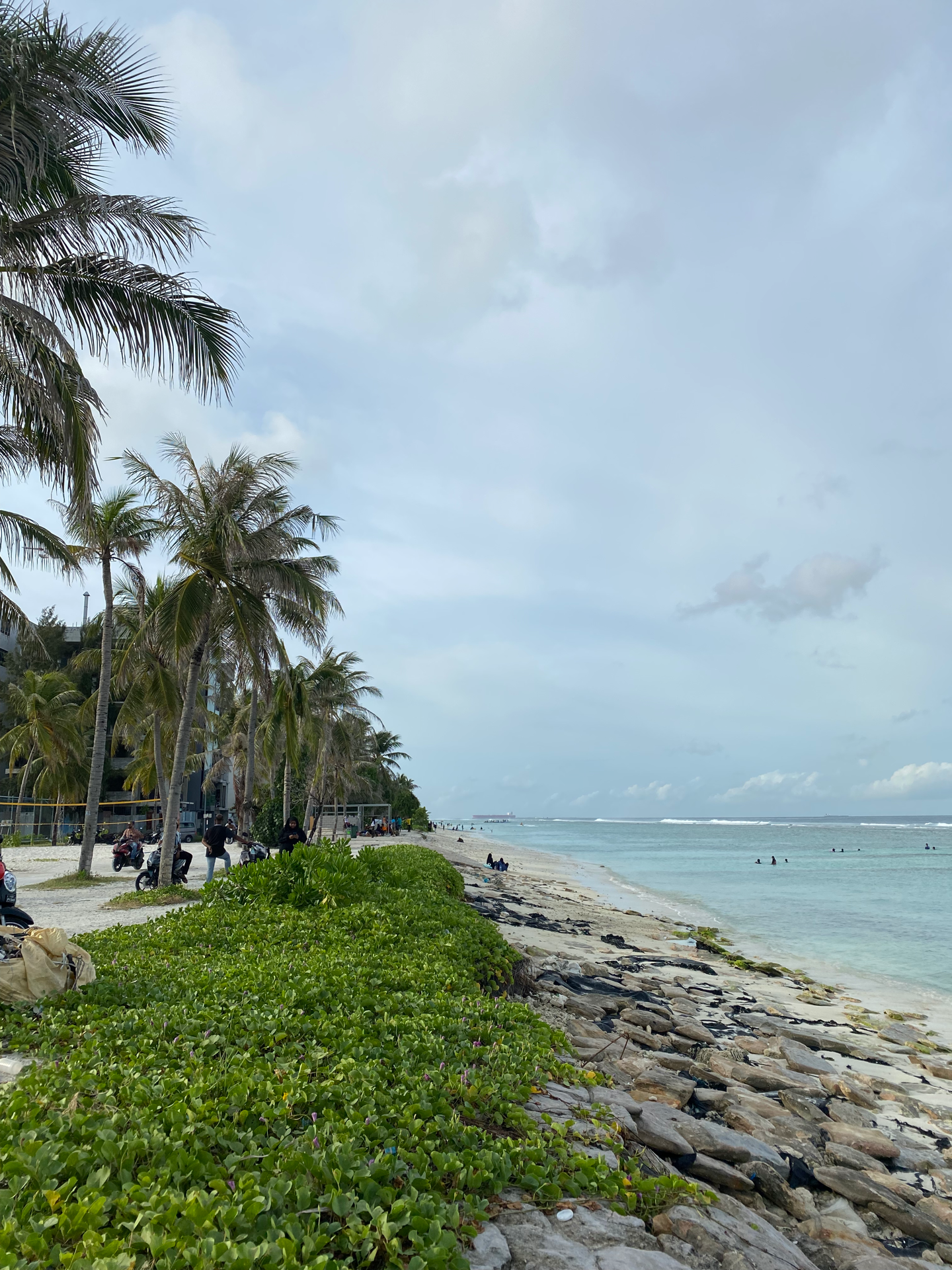
36. Hard and soft engineering solutions are often combined to protect small islands from rising seas. Hulhumale' shoreline is fortified with concrete filled geo-bags on an inclined sloped running parallel to creeping vines of beach morning glory (Ipomea Violacea) and coconut palms for a mix of engineering and nature based solutions.
Location: Hulhumalé, The Maldives
Category: Geography
Twitter: @AishathAzfa
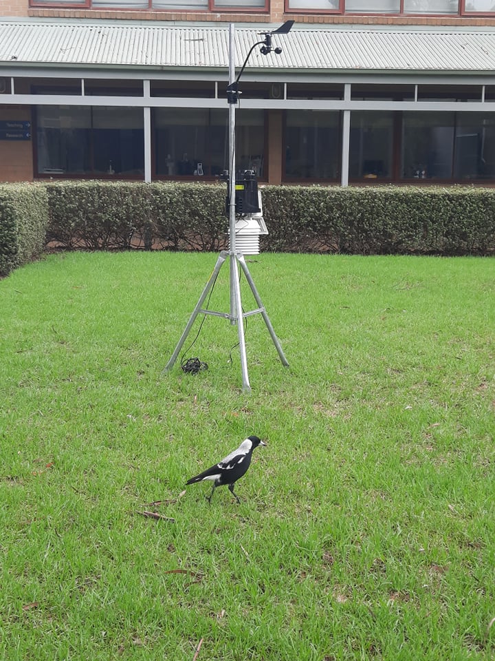
37. The brave magpie commander interrogates the strange tall bird that has landed in its territory. "Well, Metal Bird, what brings you here?" ~silence~ "Don't like talking, eh?"
Location: Unimelb Burnley Campus
Category: Climate and Weather
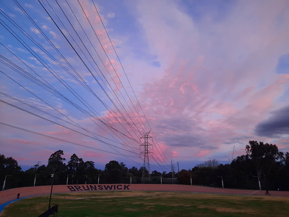
38. Molecules in the sky scatter the sunlight (Rayleigh Scattering). Shorter wavelength colours (blues) get scattered more than long wavelength colours (reds). At sunset and sunrise, light from the sun travels farther to reach our eyes than at noon when the sun is directly above us. Therefore, more red colours reach our eyes at sunset since the short wavelength colours have been diffused by scattering.
Location: Brunswick Velodrome
Category: Climate and Weather
Twitter: @kjreid95
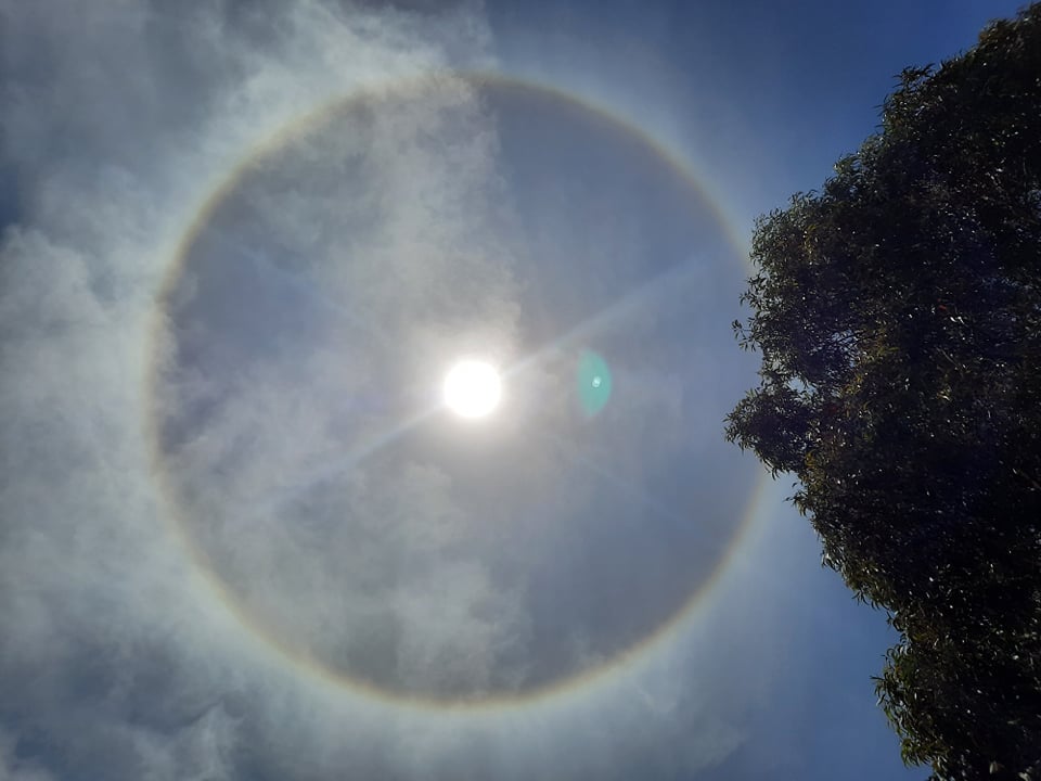
39. Sun halos are caused by ice crystals high in the sky in cirrus clouds scattering light. These ice crystals refract light at 22 degrees on average. Therefore more light gets refracted outwards than inwards making the inside appear darker and hence the halo appearance.
Location: Gilpin Park
Category: Climate and Weather
Twitter: @kjreid95
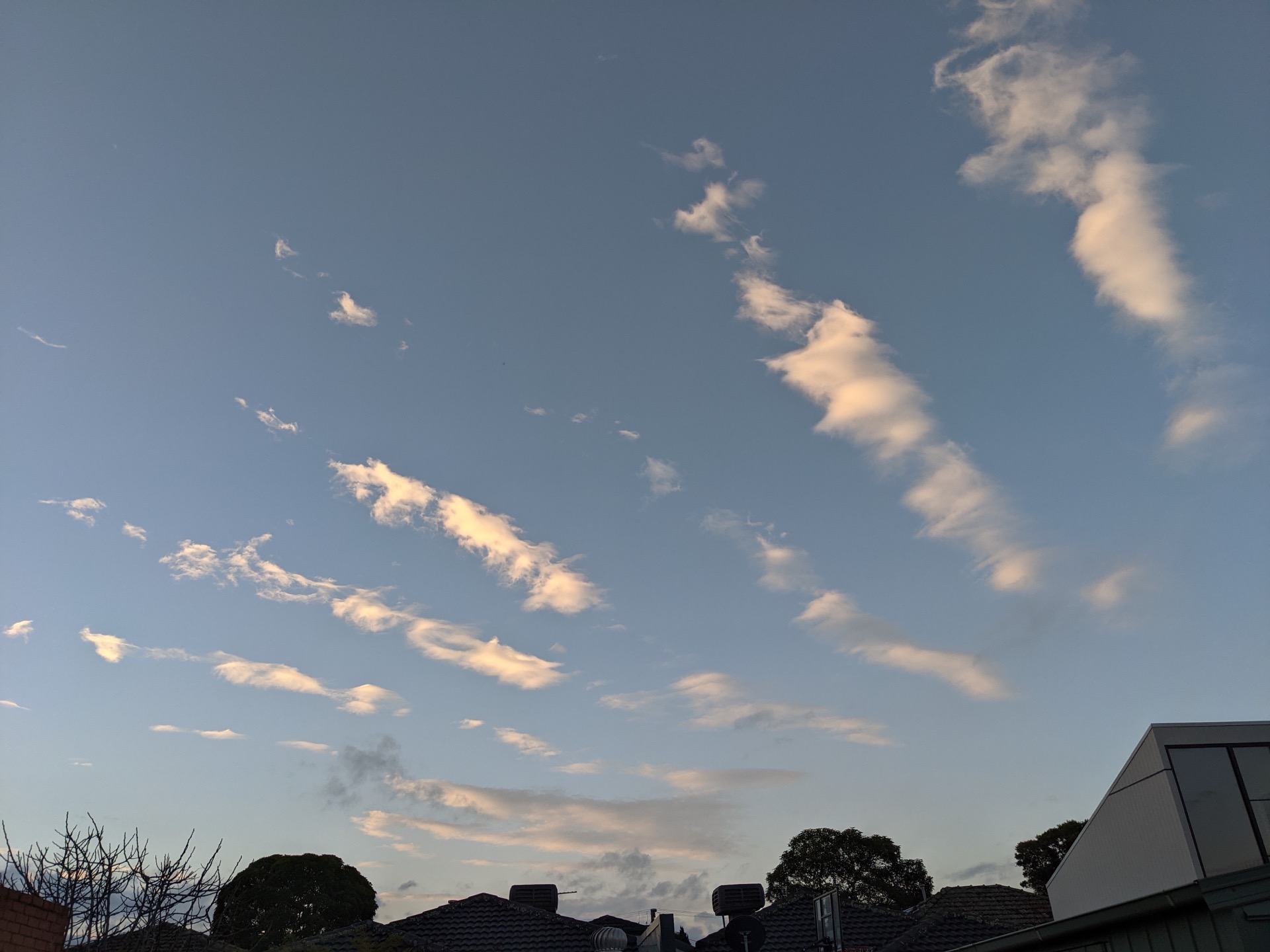
40. Ethereal altocumulus undulatus clouds as sunset, giving away the presence of a gravity wave. August 2020.
Location: My house of course! Where else would I be? Coburg North (Wurundjeri country)
Category: Climate and Weather
Twitter: @lindenashcroft
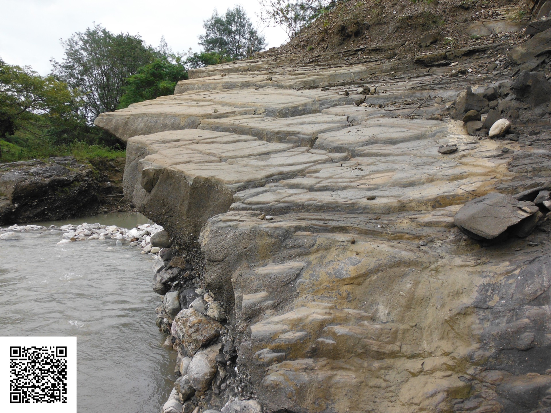
41. This photo shows a c.2Ma synorogenic debrite that grades from a boulder conglomerate at the base to a siltstone at its top surface. The bed was deposited at >1000 m depth in a rapidly-subsiding normal fault-bounded graben, within a forearc-continent collisional mountain belt. It is now 400 m above sea level (normal fault hanging wall rock-uplift rate c. 0.7mm/yr) but the basin-bounding fault is still slipping normally! Imagine the footwall uplift rate! As if that were not intriguing enough, if you look carefully at the top surface you will see a beautiful set of orthorhombic normal faults that record omni-directional extension (sigma 1 vertical, sigma 2 = sigma 3). These developed because the graben opened in response to rotational slip on the underlying fault. Use the QR code to explore the graben. Look at the impressive east-dipping sheet of triassic limestone that forms Mt Loelako to the west of the graben, That limestone has rotated both horizontally and vertically by about 70 deg. Look within the graben. Can you spot the two different orientations of normal faults? If you want to know which major fault is active, look for the Marobo hot springs. They are on the google map and well worth a visit if you ever get there.
Location: The Marobo Graben of Timor-Leste
Category: Geology
Twitter: @structuregeo
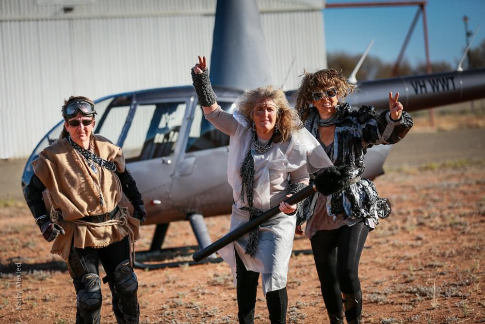
42. This is a study of the changing everyday uses of endangered tiny airports in Australia.
Location: Broken Hill Airport
Category: Geography
Twitter: @LynJG
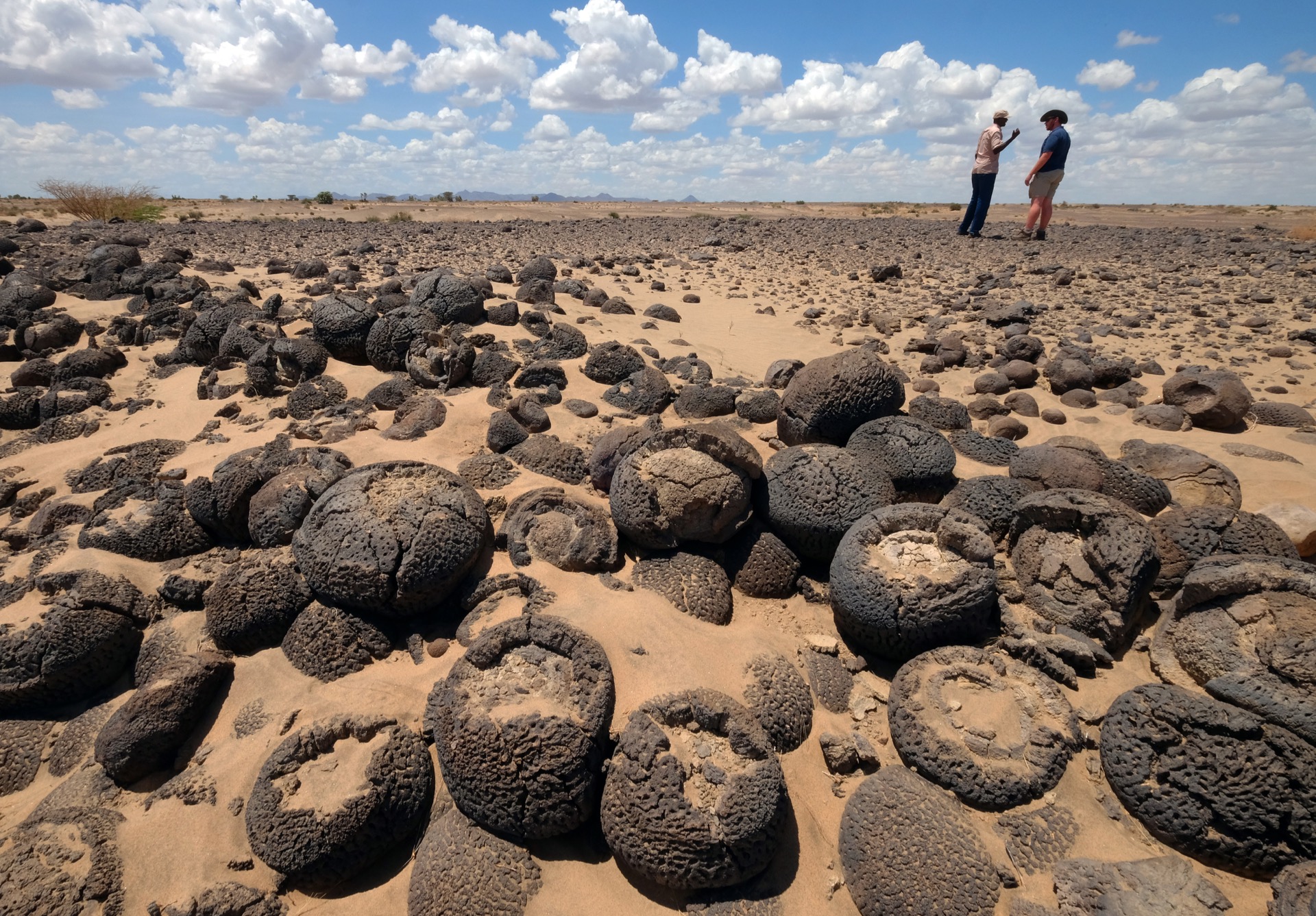
43. Now lying abandoned in an arid landscape, fossil stromatolites reflect the extent of Lake Turkana (northern Kenya) in past, wetter climates
Location: Lake Turkana, Kenya
Category: Geology
Twitter: @IsotopeDude
44. I am not a geologist myself however over the course of a few days reading many information plaques and graphics, I came to greatly appreciate why Yellowstone is one of the most studied geological sites on the planet. Although I cannot recall the exact science behind the hot spring pictured, what I do remember is that all of the beautiful colours are actually thanks to microorganisms called thermophiles that live in the world's most extreme conditions.
Location: Yellowstone National Park, Wyoming, U.S.A
Category: Geology
Twitter:

45. Looking out over the stunning Victorian Alps, I was of course immediately distracted by these beautiful cumulus congestus clouds. I was particularly excited to be standing, basically at eye-level with the lifted condensation level (LCL), the level at which a parcel becomes saturated (i.e. clouds form!). Also clear in this image are the updrafts in these clouds, highlighted by their cauliflower-like tops. These are still relatively short (they don't extend to very high altitudes) and young (early in their development) -- the mostly sharp edges tell us that most of the water is still liquid drops. Finally, if you look closely, you can see some crepuscular rays -- the shimmering light pattern below cloud base. The alps themselves are pretty nice too, but you'd have to talk to a geologist to learn more about them :-).
Location: Mount Bogong
Category: Climate and Weather
Twitter: @DrStacey21
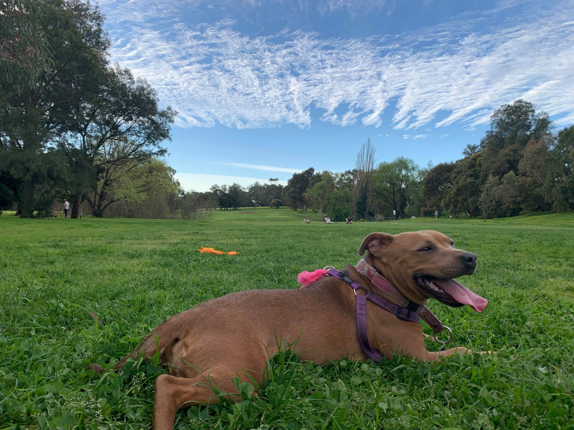
46. Princess Buttercup in the park admiring atmospheric gravity waves - clouds caused by air flowing over mountains.
Location: Melbourne
Category: Climate and Weather
Twitter: @alexborowiak
